File:Roadmapping.jpg

Size of this preview: 662 × 600 pixels. Other resolution: 968 × 877 pixels.
Original file (968 × 877 pixels, file size: 115 KB, MIME type: image/jpeg)
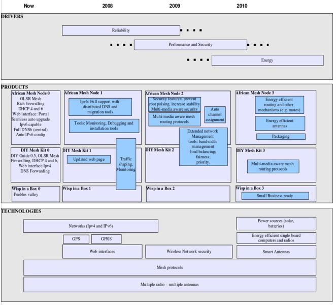
road mapping diagram
File history
Click on a date/time to view the file as it appeared at that time.
| Date/Time | Thumbnail | Dimensions | User | Comment | |
|---|---|---|---|---|---|
| current | 14:03, 13 July 2007 | | 968 × 877 (115 KB) | Kingdavid (talk | contribs) | road mapping diagram |
You cannot overwrite this file.
File usage
The following 2 pages use this file: